INDUSTRIES
A wide array of services tailored to your market sector's monitoring objectives.
OUR INDUSTRIES
Oil & Gas
![Mining cart icon]() Mining
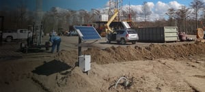
Leverage better data to manage risk and optimize operations.
View this industry
Mining
Leverage better data to manage risk and optimize operations.
View this industry
![]() Carbon Sequestration
Characterize your CO2 site and manage seismic risk.
View this industry
Critical Infrastructure
Ensure the protection of your assets from seismic hazards.
View this industry
Carbon Sequestration
Characterize your CO2 site and manage seismic risk.
View this industry
Critical Infrastructure
Ensure the protection of your assets from seismic hazards.
View this industry
Critical information to effectively manage risk and avoid shutdowns.
View this industry